
The Open Road Book: Sanctuary Map USA

🗺️ From the Green Book to Today’s Immigration Sanctuary Map 🌍 In the 20th century, the Negro Motorist Green Book helped Black Americans travel safely through a segregated United States. It offered more than travel tips — it was a lifeline, a guide to dignity, safety, and freedom of movement in an unjust world. Today, a new kind of map is quietly taking shape — one that shows sanctuary cities, counties, and states. These are places where local policies limit cooperation with federal immigration enforcement. While protections vary, many immigrants find these jurisdictions to be safer ground for building their lives. 🧭 Whether you’re traveling, relocating, or just trying to stay informed, it helps to know where local support and community networks exist.
🟤 How to Use The Open Road Book: Sanctuary Map USA
Step 1: Open the map link.
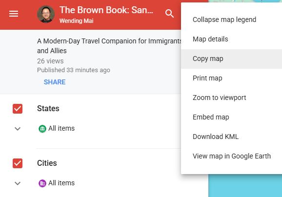
In the top-left panel, click the three dots and select “Copy map” to create your personal version. This allows you to customize without altering the original.
Step 2: Use the search bar to find your destination. In the small pop-up window that appears, click “Directions to here.” A new route layer will be added to your map.

Step 3: At the bottom of the left panel, enter your starting point. Google Maps will generate a default route from your location to your destination.
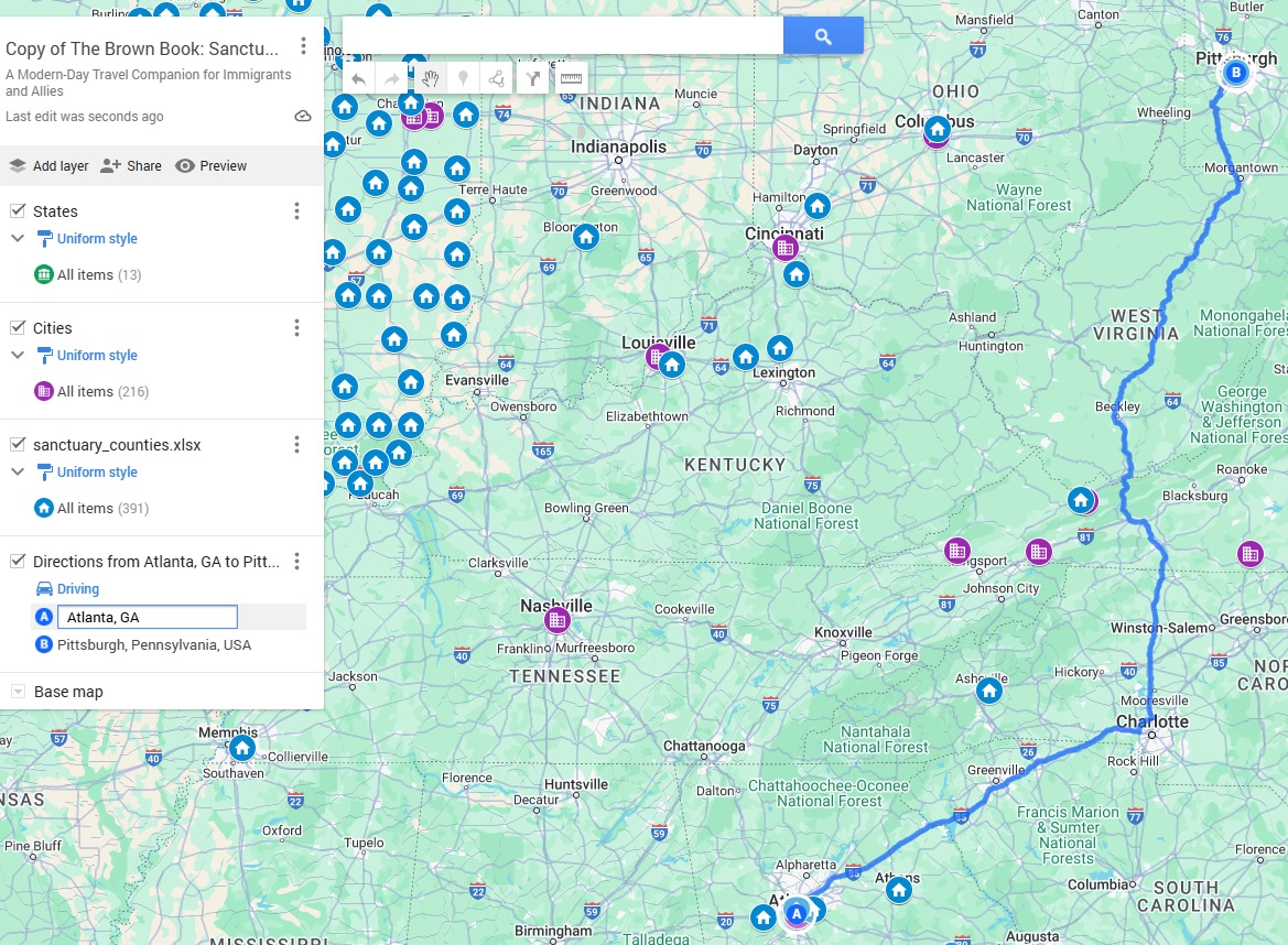
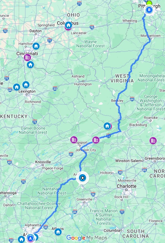
Step 4: You can drag the route to adjust your path, including sanctuary jurisdictions as you see fit—whether you're seeking safer stops or simply customizing your journey.
🛑 Note: Your changes only affect your copied version of the map. The original Open Road Book map remains unchanged and available for others. 📍 Stay informed. Stay prepared. Stay safe, immigrants.
Data Source: https://www.dhs.gov/sanctuary-jurisdictions (Published by DHS on 05/30/2025, retracted on 06/01/2025. Though retracted, the data might still be helpful as a reference).